Building an interstate visualization
Data hell
February 21, 2026
I've always been a fan of the US interstate system, and driving across the country from NYC to SLC had me enjoying the fruits of the labor of Mr. Dwight D Eisenhower.
Building the visualization
Claude is a beast and got through a lot of the initial coding, but ran into a couple roadblocks early on. The actual visualization is very easy to build, but getting the data cleaned up proved to be the biggest challenge. I initially started with data.gov and a Highways: US Interstates entry that looked promising, but like most things from the federal government, it proved to be pretty fucking useless.
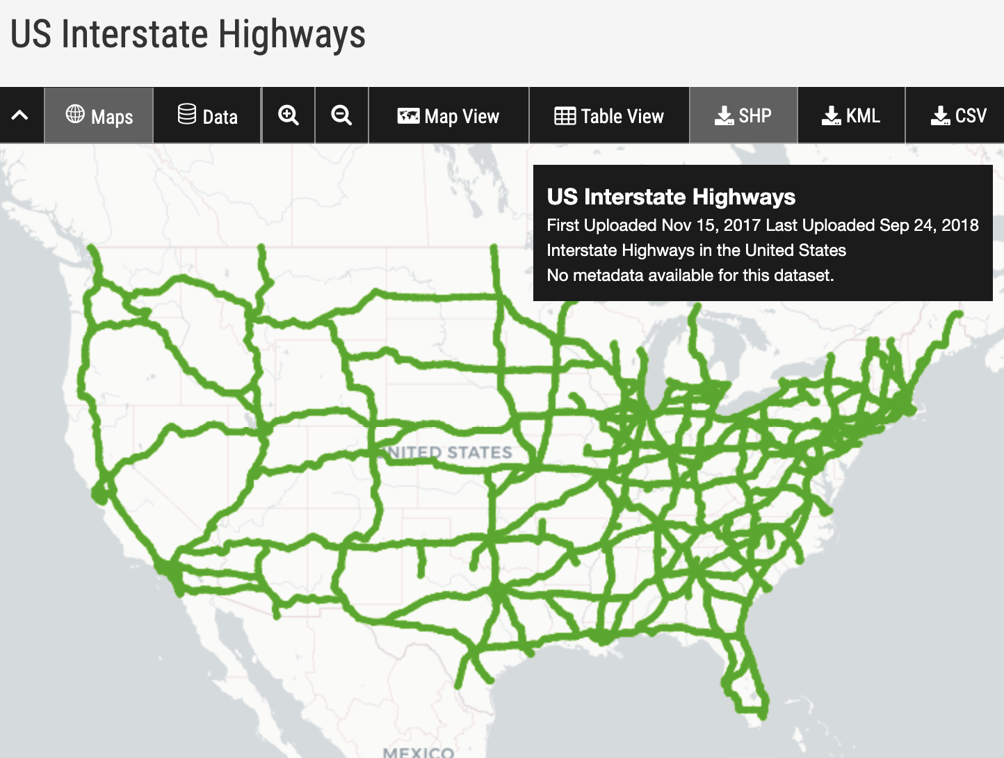
Looking around, I found a clean visualization from a random website that seemed to have all of the shape files for the different interstates.
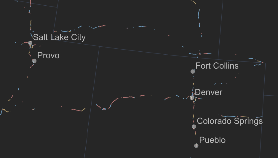
After downloading the data and setting up the initial visualization though, I realized that the data is pretty fucked. The interstates don't actually seem to be properly labeled, and a lot of pieces of it are cut off / missing.
While trying to find the right data, you can find really interesting projects others have done, like this interstate system as a subway map.
After doing some more digging, I decided to clean up my own dataset for this project. I downloaded the entire database of North American roads (500MB!) then had Claude clean up the data to pull only interstates and simplify the data. Got the data to a reasonable level but still lagged, so I made some more optimizations.
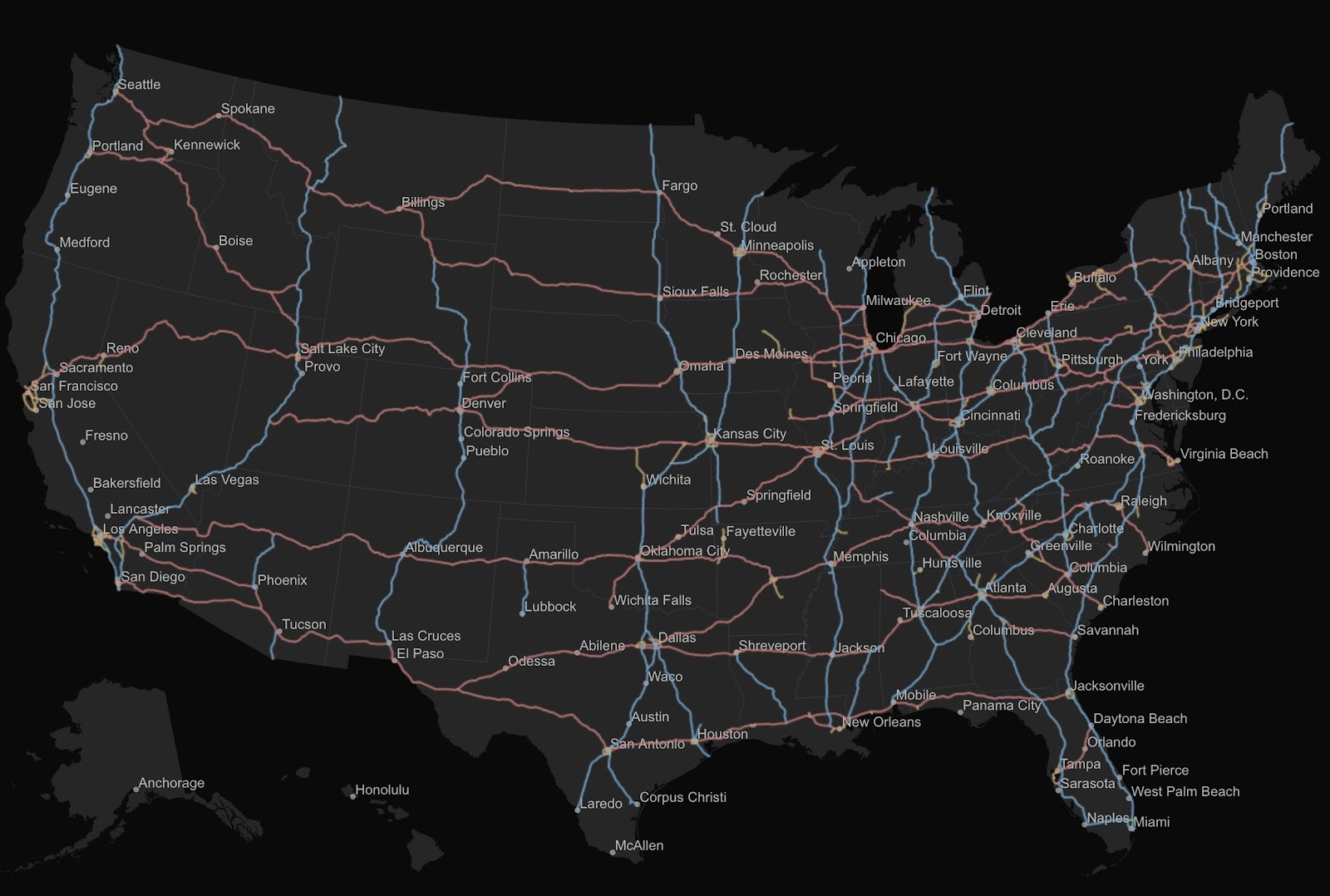
After some more data cleaning (reduced the resolution of the SVG paths, consolidating them into longer but fewer paths, etc), I've gotten to a pretty clean geojson, which is available for download here, and yields a pretty clean visualization.